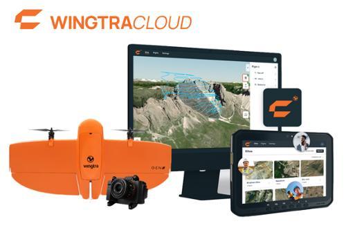
WingtraCLOUD Pro is drone surveying software designed to connect office planning with field data capture for Wingtra mapping projects. The platform supports project managers, surveyors, and pilots through site setup, flight planning, data capture, and geotagging workflows. Pro tools support complex mission planning, coordinate reference system transformation, imported planning data, project synchronization, and team collaboration across devices and locations.
WingtraCLOUD Pro supports aerial surveying and mapping workflows that require coordinated mission planning, repeatable field execution, and accurate positioning data. Users can plan missions with terrain and coordinate-system context, import supporting map data, review and comment on flight plans, synchronize plans to connected field devices, manage sites digitally, and prepare geotagged aerial imagery for downstream photogrammetry, CAD, and GIS workflows.
Plan
Plan complex survey missions using terrain, coordinate system, and obstacle context. Wingtra software provides 3D flight planning with terrain context and supports imported GeoJSON layers, orthoimages, and terrain models. Pro planning tools also include ground sample distance, flight height, and visual line-of-sight visualization.
Capture
Review and share flight plans with team members before field operations, then synchronize the latest mission to a connected field tablet. In the field, operators can check the mission, complete guided pre-flight checks, and capture aerial imagery and GNSS data.
Geotag
Upload drone data and a GNSS correction source after flight to create corrected geotags. Wingtra applies GNSS corrections and transforms geotags into the project coordinate system for use in downstream processing workflows.
Collaborate
Share flight plans with team members for review and comments before flying. Projects and flight plans can synchronize across connected devices, helping office and field teams work from the latest project information. The Pro overview also documents multi-user collaboration in a browser and digital site management.
Integrate
Use corrected aerial data in existing photogrammetry, CAD, and GIS workflows. Wingtra software can export geotagged images and associated geotag information for downstream processing.
Key Features:
Includes Wingtra Essential functionality plus Pro capabilities
Advanced 3D flight planning with terrain context
Coordinate reference system transformation
Access to more than 6,500 published coordinate systems
Import GeoJSON layers, orthoimages, and terrain models for flight planning
Import DXF, background, and elevation maps for flight plans
Visualize ground sample distance along the flight path
Visualize flight height and line of sight
Review and comment on flight plans before flying
Synchronize flight plans between connected devices
Coordinate projects across multiple pilots
Manage sites digitally
Import RINEX and .t0x files from GNSS workflows
Support Network Corrections powered by Trimble PP-RTX
Guided base station and checkpoint setup with WingtraGROUND
Generate corrected geotagged imagery for downstream processing workflows