View Cart
0
Shop by Category
View Cart
0
Home Unmanned Autonomous Solutions Accessories RTK/PPK EMLID REACH RS4 ALL-BAND RTK GNSS RECEIVER

EMLID REACH RS4 ALL-BAND RTK GNSS RECEIVER

Calculating price...
PART: RCH401
SUPPLIER: Emlid
QUANTITY

About This Item:

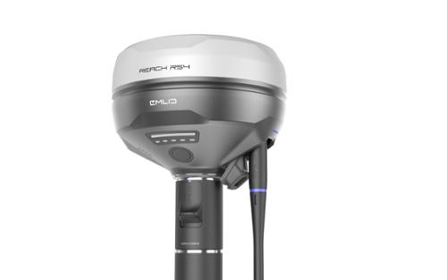
The Emlid Reach RS4 is an all-band RTK GNSS receiver with tilt compensation designed for surveying and positioning in open and challenging environments, including dense canopy and urban areas. It tracks 672 GNSS channels across GPS, GLONASS, Galileo, BeiDou, QZSS, and NavIC signals and provides RTK positioning accuracy of 7 mm + 1 ppm horizontally and 14 mm + 1 ppm vertically. Tilt compensation is specified at RTK + 2 mm + 0.3 mm/°, allowing measurements without keeping the survey pole level.

The Reach RS4 supports applications including topographic surveys, construction layout, boundary marking, as-built checks, utility mapping, road alignment, and earthwork measurements. For RTK corrections, the receiver supports NTRIP, an 868/915 MHz LoRa radio, and a two-way 410 to 470 MHz UHF radio. It also works with Emlid Flow for receiver configuration, RINEX logging, data collection, and stakeout, while Emlid Flow 360 provides web-based project management and data sharing.

All-Band GNSS

The Reach RS4 provides 672 GNSS tracking channels and supports GPS L1C/A, L2C, and L5; GLONASS L1OF and L2OF; Galileo E1-B/C, E5a, and E6; BeiDou B1I, B1C, B2a, and B3I; QZSS L1C/A, L1C/B11, L2C, and L5; and NavIC L1-SPS Data and L5-SPS. GNSS update rates are supported up to 10 Hz.


Tilt Compensation

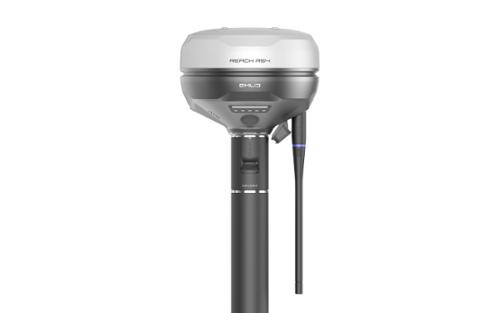
The Reach RS4 provides tilt compensation with specified performance of RTK + 2 mm + 0.3 mm/°. This allows survey measurements to be collected without keeping the pole level, supporting work near structures, on slopes, and in other locations where vertical pole positioning may be difficult.


RTK Correction Connectivity

The Reach RS4 supports multiple options for RTK corrections. Its integrated 868/915 MHz LoRa radio supports distances up to 8 km under Emlid's listed U.S. specifications, while its two-way UHF radio operates from 410 to 470 MHz with output power up to 2 W, subject to regional regulations. The receiver also supports NTRIP and RTCM3 correction protocols through internet-based connections.

Magnesium Alloy Body
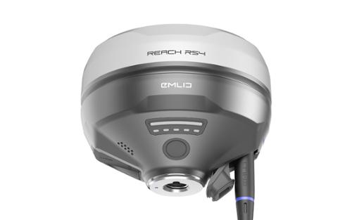
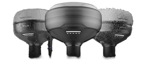
The Reach RS4 features a magnesium alloy body with a weight of 927 g. Its enclosure carries an IP68 ingress protection rating and is designed for operation in temperatures ranging from -40°C to +65°C.


16 Hours on One Charge
The Reach RS4 uses a 5000 mAh, 7.2 V, 36 Wh Li-ion battery that provides up to 16 hours of operation as an RTK rover with tilt compensation and up to 22 hours of GNSS logging. Charging is supported through USB Type-C Power Delivery.
IP68 Ingress Protection
The Reach RS4 has an IP68 ingress protection rating for field operation in environments exposed to dust and water. The receiver combines its IP68-rated enclosure with a magnesium alloy body for field surveying applications.


Operating Temerature
The Reach RS4 has a specified operating temperature range of -40°C to +65°C (-40°F to 149°F), supporting field data collection across a broad range of environmental temperatures.

Coordinate Your Team
The Reach RS4 works with Emlid Flow for field surveying and Emlid Flow 360 for web-based project management. Emlid Flow supports receiver configuration, RINEX logging, data collection, and stakeout, while Emlid Flow 360 allows users to prepare and manage projects and export and share survey data.
 
Execute Projects on Site

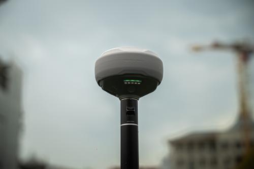
The Reach RS4 supports a range of surveying, construction, mapping, and field measurement applications:

-Topographic Surveys: Collect positioning data for topographic surveying.

-Construction Layout: Use RTK positioning for construction layout and field positioning.

-Boundary Marking: Collect and stake positioning data for boundary work.

-As-Built Checks: Capture survey data for checking completed work.

-Utility Mapping: Collect positioning information for utility mapping workflows.

-Road Alignment: Support field positioning and surveying for road alignment.

-Earthwork Measurements: Collect field measurements for earthwork applications.


Key Features:
  • All-band RTK GNSS receiver with 672 tracking channels
  • GPS, GLONASS, Galileo, BeiDou, QZSS, and NavIC support
  • RTK accuracy of 7 mm + 1 ppm horizontal and 14 mm + 1 ppm vertical
  • Tilt compensation specified at RTK + 2 mm + 0.3 mm/°
  • Factory-calibrated second-generation tilt compensation
  • 868/915 MHz LoRa radio
  • Two-way 410 to 470 MHz UHF radio
  • NTRIP and RTCM3 correction support
  • Global LTE modem with Nano-SIM support
  • Wi-Fi and Bluetooth connectivity
  • Up to 16 hours as an RTK rover with tilt compensation
  • Up to 22 hours of GNSS logging
  • 16 GB internal storage
  • Magnesium alloy body
  • IP68 ingress protection rating
  • -40°C to +65°C operating temperature
  • Emlid Flow and Emlid Flow 360 software support


EMLID REACH RS4 ALL-BAND RTK GNSS RECEIVER SPECIFICATION SHEET

There are currently no specs for this product.